
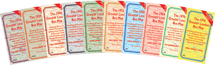
Based on the same style of map as the current issue, the historical maps will be of particular interest to transport historians, and those simply wishing to have a nostalgic look at the transport in London in years gone by. They make ideal presents for those who may just remember how buses used to be! The maps are available from some of the usual outlets, or direct from me by post.
All these historical maps show many services and details of special journeys which have never before appeared on any map. They show all railway lines and stations, along with Green Line Coaches and other operators' services, thus presenting the entire public transport operation in London on a single map.
The historical maps would not be possible without assistance from many friends over the years who have given a great deal of their time to undertake the extensive detailed research necessary, and offer advice and suggestions. Among those to whom I wish to offer my sincere thanks and appreciation are, in alphabetical order, Laurie Akehurst, David Bowker, John Bull, Paul Carpenter, Ken Glazier, Chris Holland, Richard Moseling, Andrew Robertson, David Ruddom, Colin Stannard, Michael Stephens, Dave Stewart, Les Stitson.
Digital copies of these maps can also be purchased from The Greater London Bus Map Shop.
You can see a few Reviews about my maps on my Reviews page.
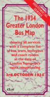
This map shows all London’s Central bus, tram, trolleybus and Green Line coach services as at 3rd October 1934, the day on which London Transport renumbered many routes from the former Metropolitan Police ‘Bassom System’ of numbering into its own sequence following the acquisition of most of the London independent operators, although a few were still running at this time. The Green Line coach routes were lettered rather than numbered. The first trolleybus routes had started in south-west London a few years earlier.
Price £5 (5 GBP) printed / £2 (2 GBP) digital
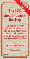
This map shows all London's Central bus, tram, and trolleybus services as at 11th June 1939, before the outbreak of The Second World War. The Green Line network of coaches was in its last few months as these too were withdrawn at the start of the war. The coach routes were lettered from A1 to Z2, and these are also shown on the map within the London area. Stations at Uxbridge High Street, Connaught Road, Gallions, among others, are included.
This second edition has been updated with new information since the original publication.
Price £4 (4 GBP) printed / £2 (2 GBP) digital
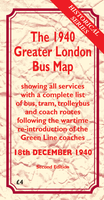
This map shows all London's Central bus, tram and trolleybus services as at 18th December 1940, during The Blitz. The Green Line coaches had been reinstated using route numbers between 2 and 58, and these services have never before appeared on a published bus map. The blackout operations are also shown. Stations at Beckton, Burdett Road, Leman Street, St Ann's Road and Shadwell St George's East, among others, are included. Production of London Transport road services maps had been suspended at this time owing to wartime hostilities.
This second edition has been updated with new information since the original publication.
Price £4 (4 GBP) printed / £2 (2 GBP) digital
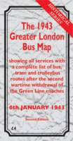
This map shows all London's central bus, tram and trolleybus services as at 6th January 1943, approximately half way through the Second World War. The Green Line coaches had been withdrawn for the second time the previous year, and London's buses had settled down to a period of relative stability. The blackout operations are also shown. Stations at Hackney, Poplar and Tidal Basin, among others, are included. No London Transport road services maps were produced at this time.
This second edition has been updated with new information since the original publication.
Price £4 (4 GBP) printed / £2 (2 GBP) digital
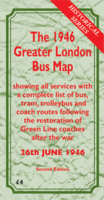
This map shows all London's Central bus, tram and trolleybus services as at 26th June 1946. On this date the restoration of the Green Line Coach network was completed following the war. The map shows buses, trams and trolleybuses, along with Green Line coaches, on the same geographic map. It also shows the railway network prior to the post-war extension of the Central Line to Ruislip, Epping and Hainault.
This second edition has been updated with new information since the original publication.
Price £4 (4 GBP) printed / £2 (2 GBP) digital
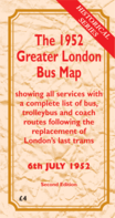
This map shows all London's Central bus and trolleybus services as at 6th July 1952. On this date the Central Area summer programme of service changes was introduced, and the last London trams were replaced. It also includes British Railways' lines to Stanmore Village, Alexandra Palace and Crystal Palace High Level.
This second edition has been updated with new information since the original publication.
Price £4 (4 GBP) printed / £2 (2 GBP) digital
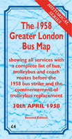
This map shows London's Central bus and trolleybus services as at 30th April 1958. On this date the Central Area summer programme of service changes was introduced, the last changes before the devastating bus strike which lasted from 5th May until 20th June. The map shows the trolleybus network before the commencement of the replacement programme which began in 1959.
This second edition has been updated with new information since the original publication.
Price £4 (4 GBP) printed / £2 (2 GBP) digital
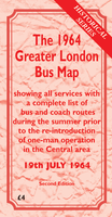
This map shows London's Central bus services as at 19th July 1964. On this date the second stage of the Camden Town one-way system was introduced. At this time the network was particularly complex, with very many weekend variations to routes, including numerous routes with suffix letters. The map shows the extensive diversions owing to the rebuilding of Oxford Circus station, in connection with the construction of the new Victoria Underground line.
This second edition has been updated with new information since the original publication.
Price £4 (4 GBP) printed / £2 (2 GBP) digital
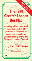
This map shows all London's bus services as at 1st January 1970. On this date control of London Transport's Central Buses was transferred to The Greater London Council, with the Country Bus Department being taken over by the newly-formed "London Country Bus Services Limited", part of the National Bus Company.
This second edition has been updated with new information since the original publication.
Price £4 (4 GBP) printed / £2 (2 GBP) digital

You can also buy the full printed series of Historical Maps as a set from my online shop.